Map Projections Blog
Tuesday, November 19, 2013
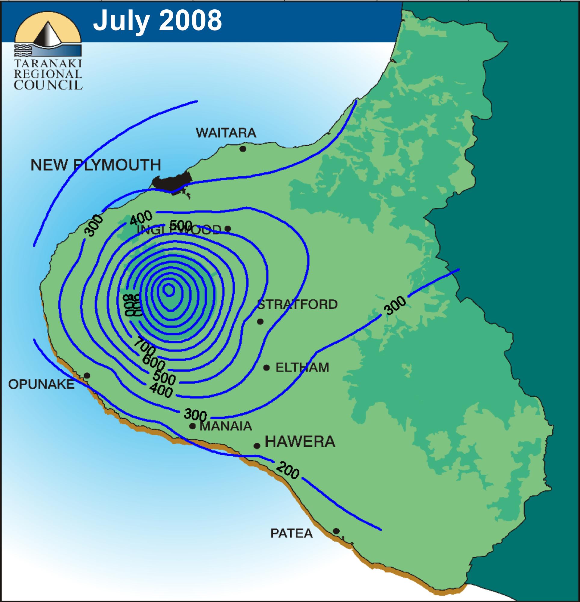
Isoyet
http://www.scoop.co.nz/stories/AK0808/S00090.htm
Isoyets are rainfall maps. This map shows August 2008 rainfall in 100 mm bands. Isoyets are typically defined as a line drawn on a weather map that connect points that get the same amount of rainfall during a specific time period.
No comments:
Post a Comment
Newer Post
Older Post
Home
Subscribe to:
Post Comments (Atom)
No comments:
Post a Comment