Map Projections Blog
Tuesday, November 19, 2013
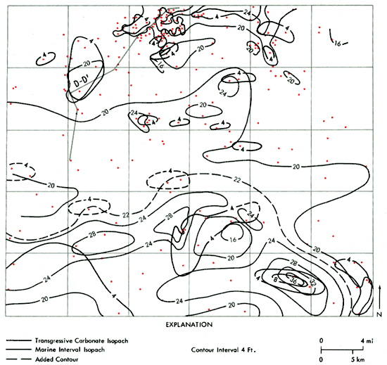
Isopach
http://www.kgs.ku.edu/Publications/Bulletins/220/06_expl.html
Isopach maps look at rock and sediment thickness. More specifically, these are contour lines of equal thickness across a given area. This map specifically shows the thickness of sedimentary cycle of A-zone carbonate in Rawlins county.
No comments:
Post a Comment
Newer Post
Older Post
Home
Subscribe to:
Post Comments (Atom)
No comments:
Post a Comment