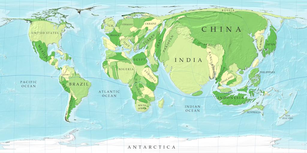
Cartograms are distorted to represent non geographic information about different countries, regions, and continents. This can be used to understand political, social, historical, economic, and all other factors of data. This puts the eye into a new perspective. The map above shows population size weighted through land area. As you can see, China and India are the most overcrowded.
No comments:
Post a Comment